-
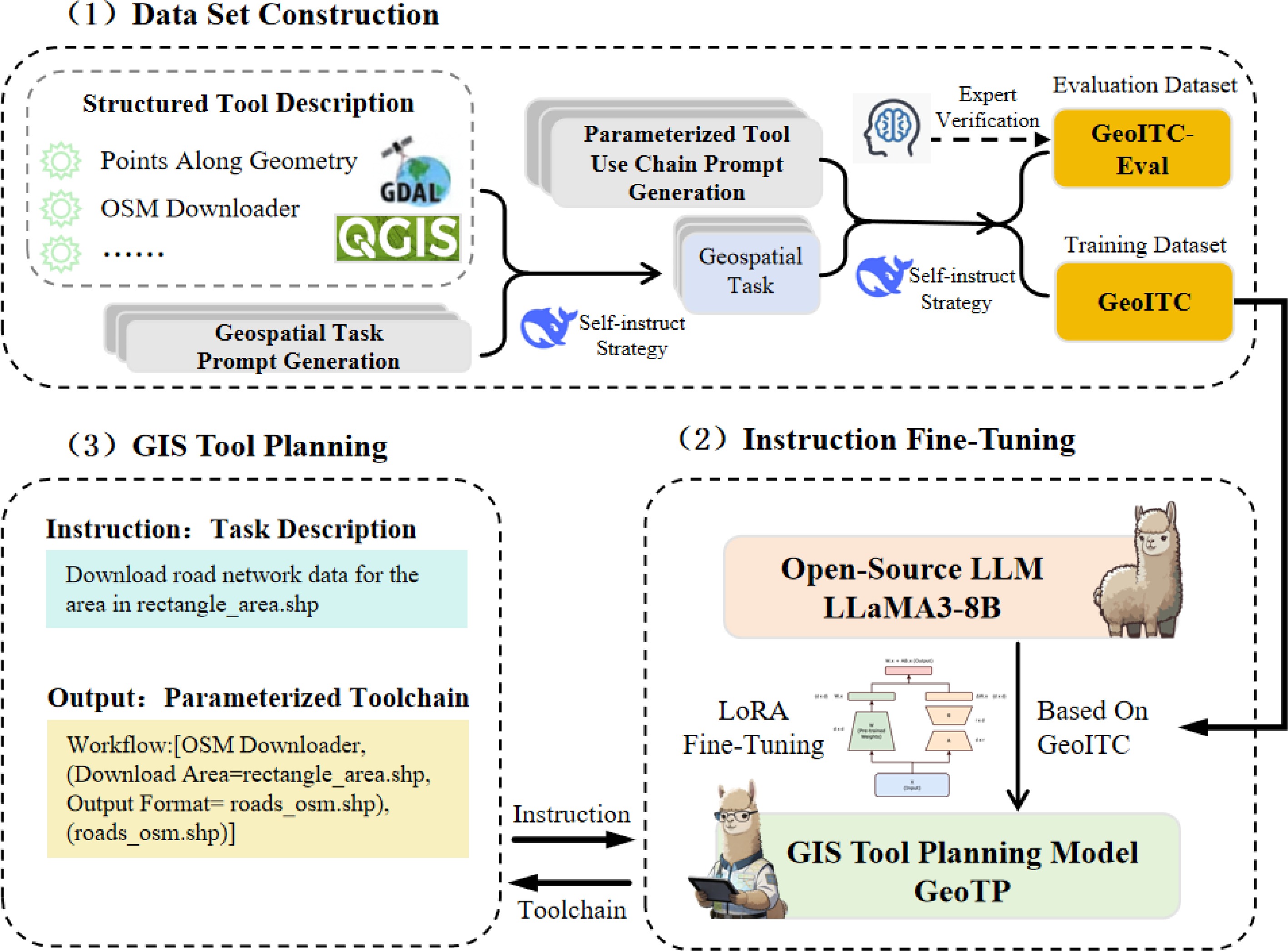
Figure 1.
The framework of the GIS tool planning model GeoTP.
-
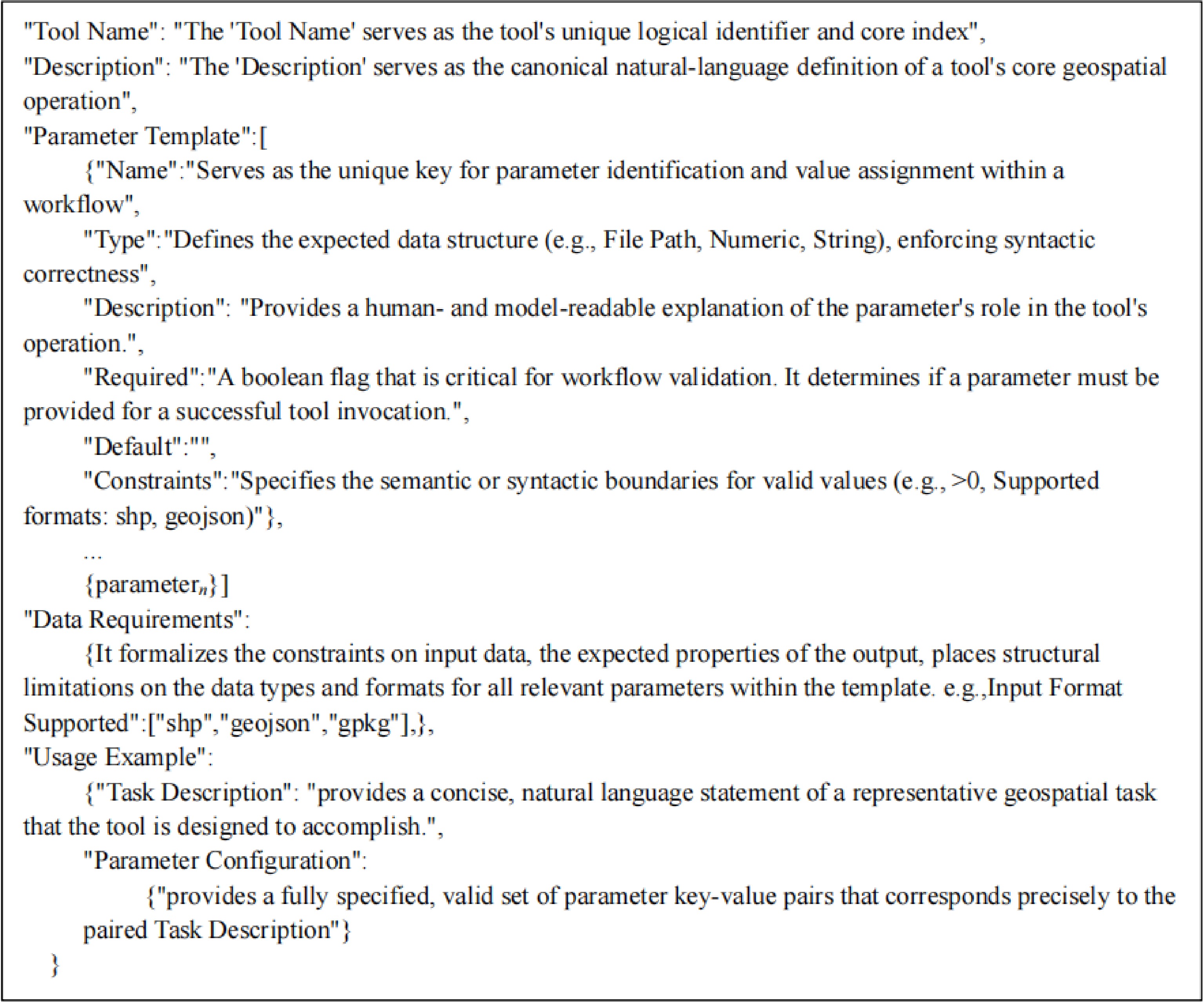
Figure 2.
Structured tool description template.
-
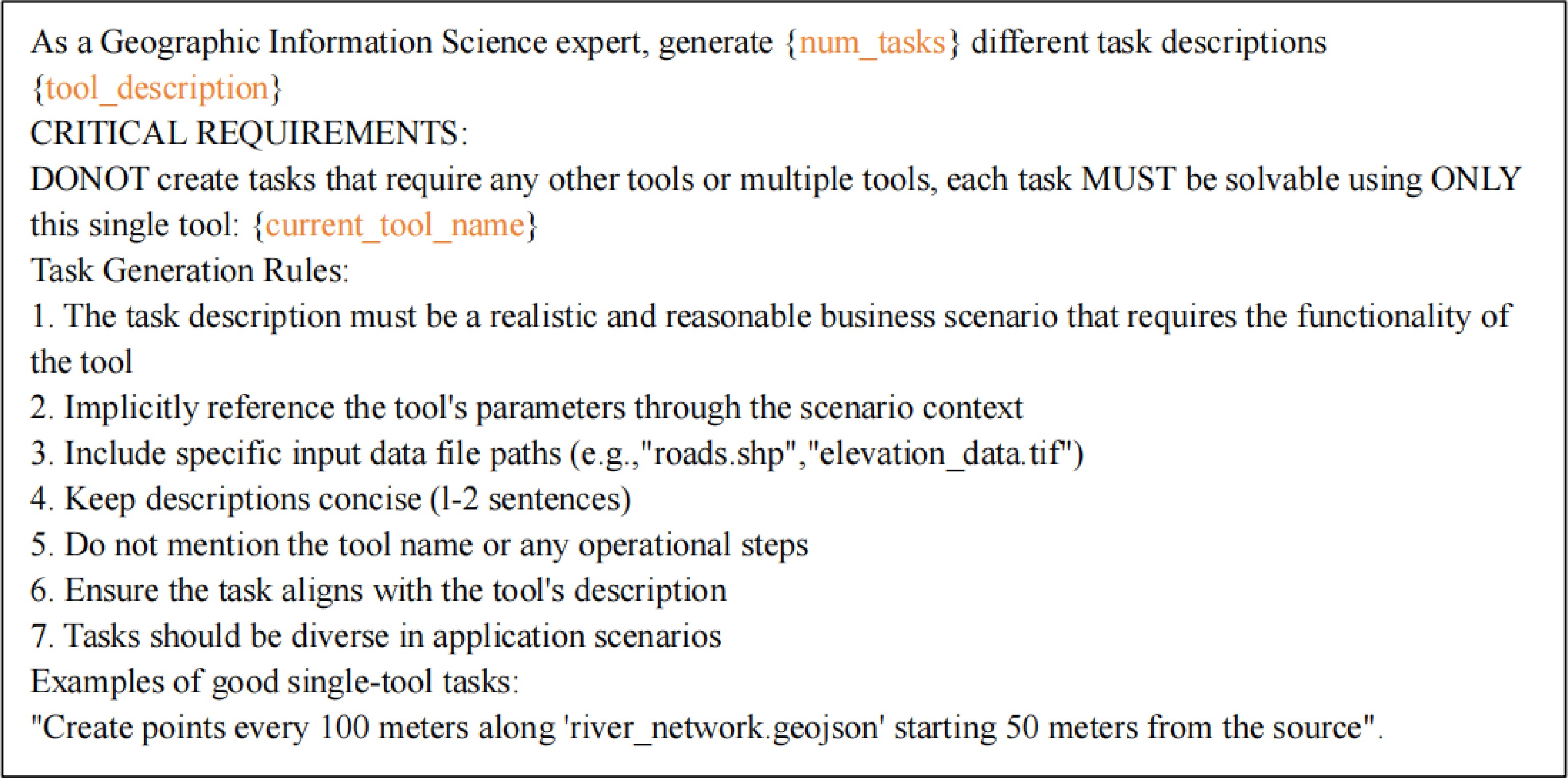
Figure 3.
The prompt for single-tool geospatial task generation.
-
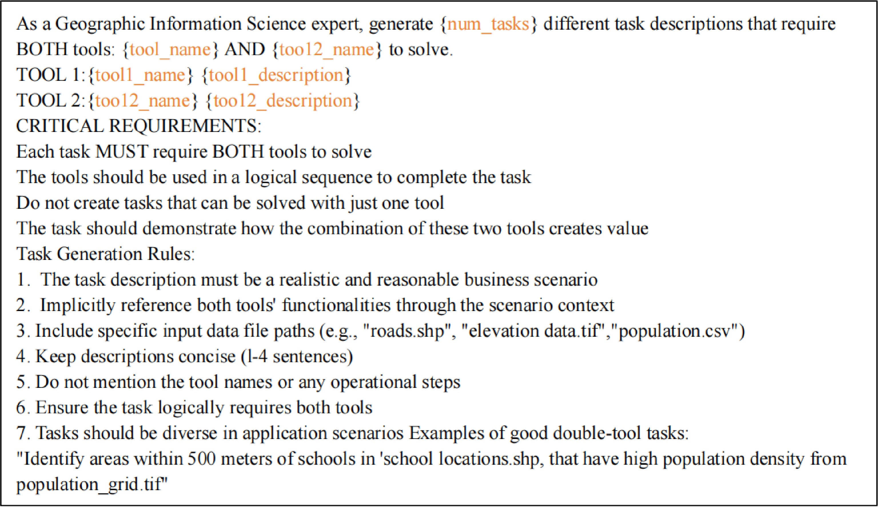
Figure 4.
The prompt for dual-tool geospatial task generation.
-
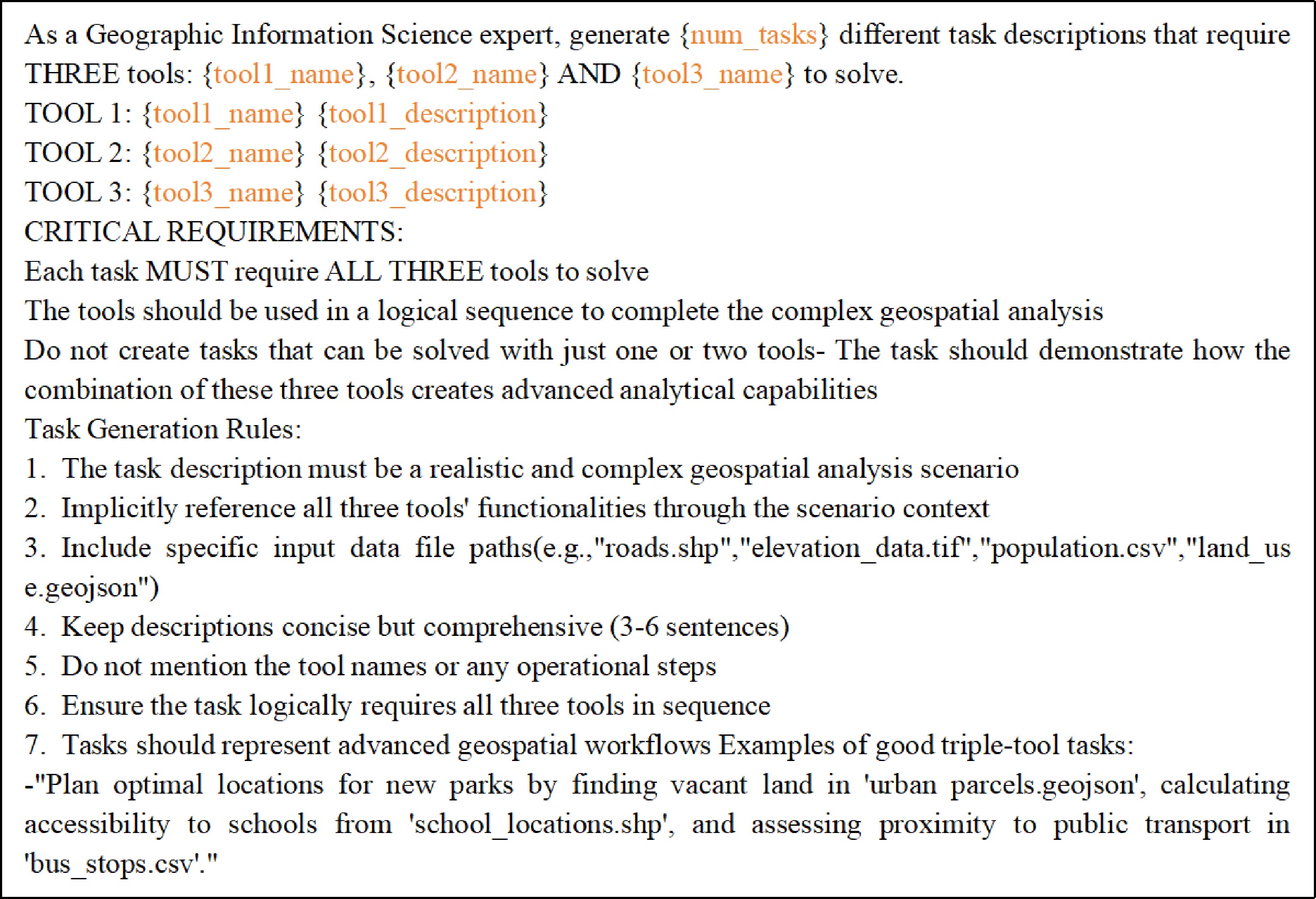
Figure 5.
The prompt for three-tools geospatial task generation.
-
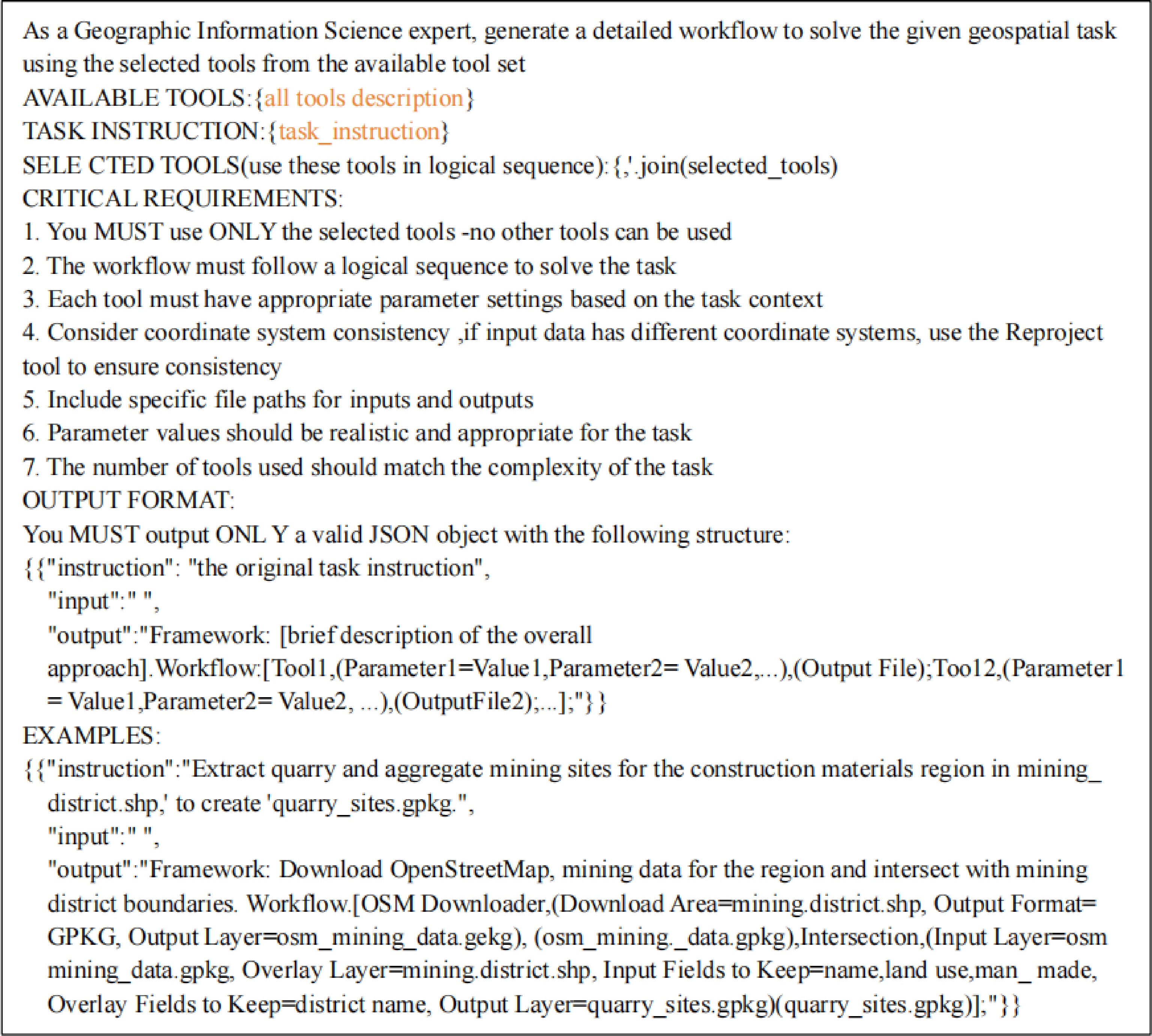
Figure 6.
The prompt used for parameterized tool-use chain generation.
-
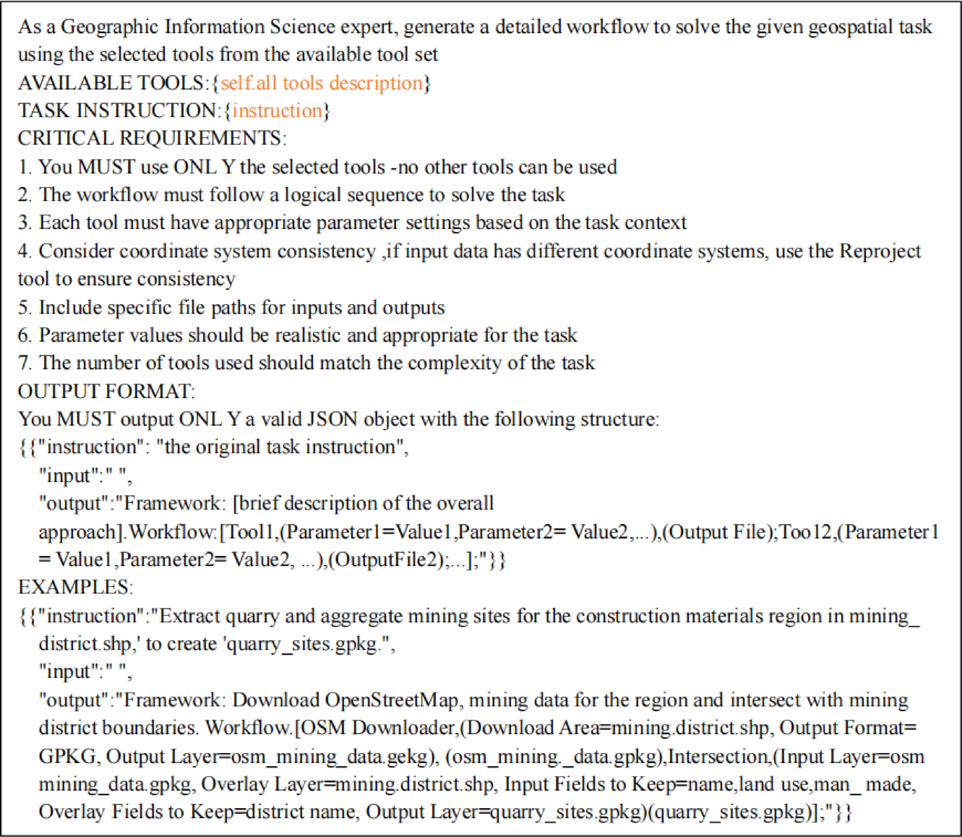
Figure 7.
Baseline models generate prompts for parameterized tool-use chains.
-
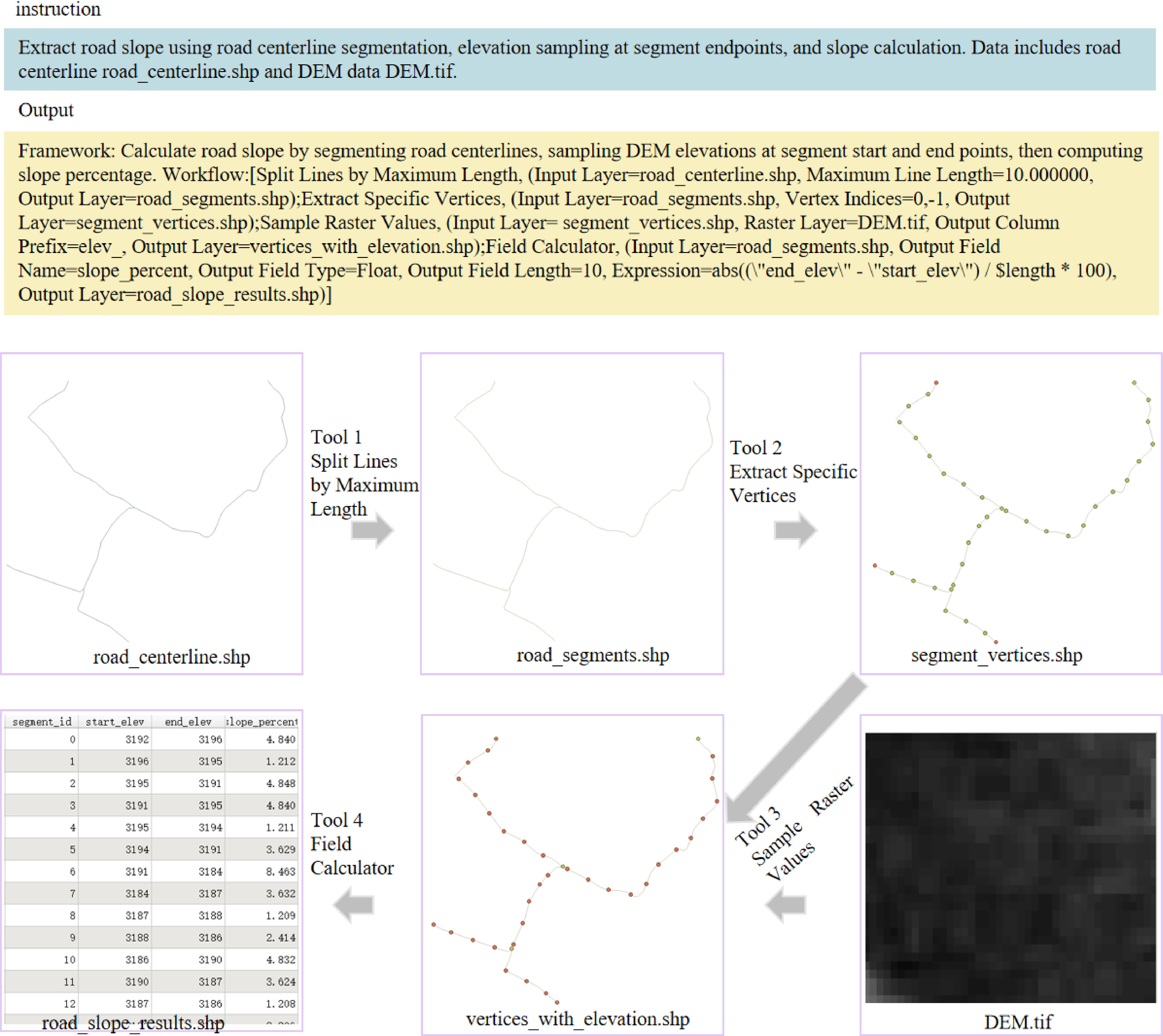
Figure 8.
Case 1: demonstration of GeoTP using four tools to calculate the road slope.
-
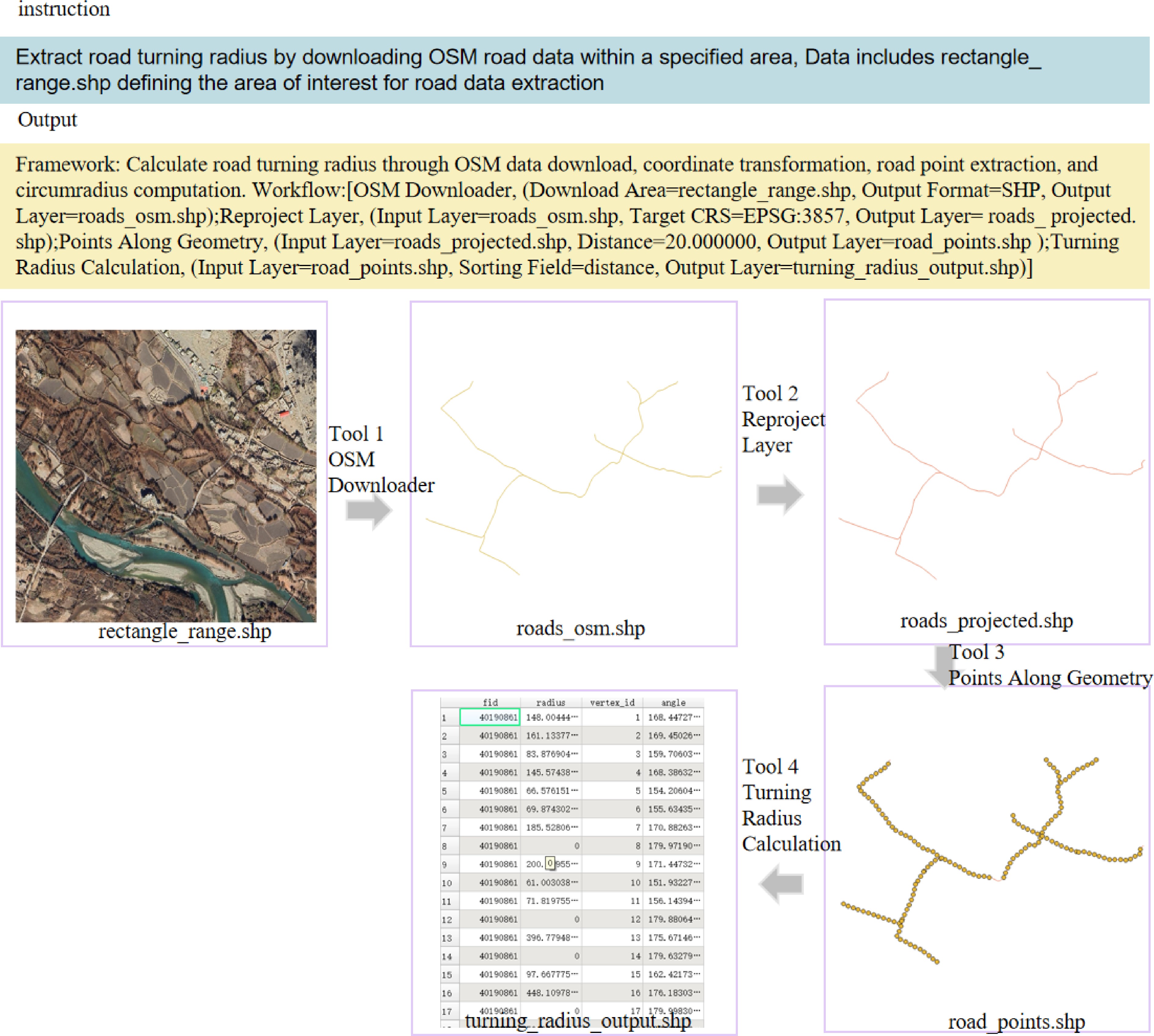
Figure 9.
Case 2: demonstration of GeoTP using four tools to calculate the road turning radius.
-
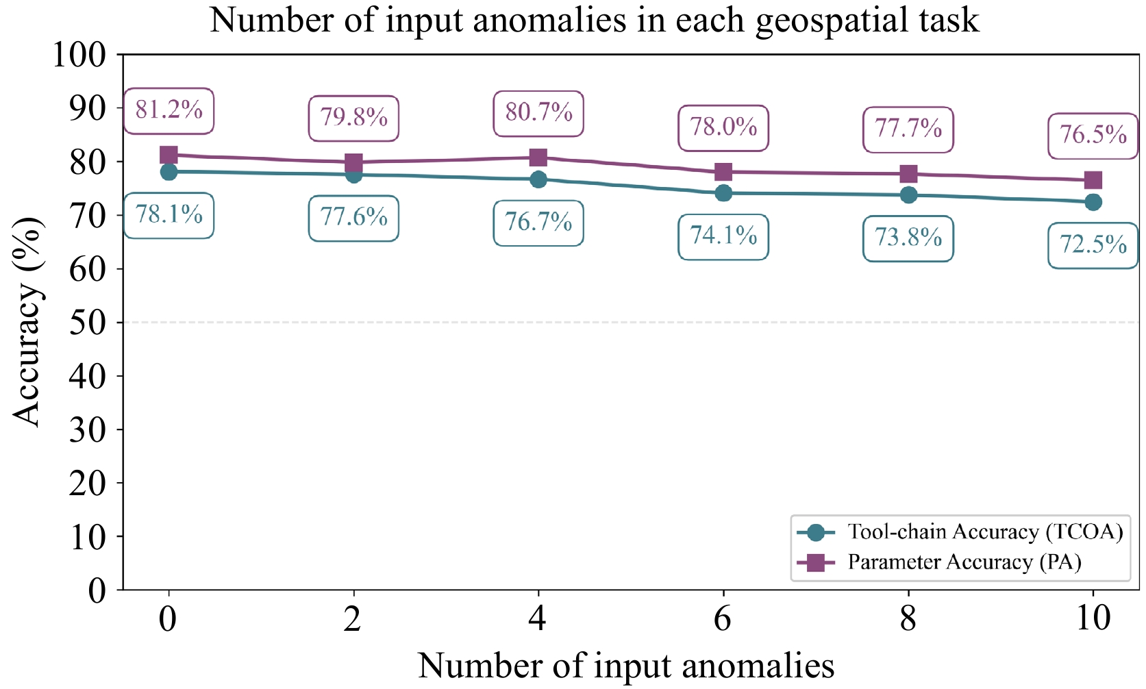
Figure 10.
Performance of GeoTP in processing anomalous input data on the GeoITC-Eval dataset.
-
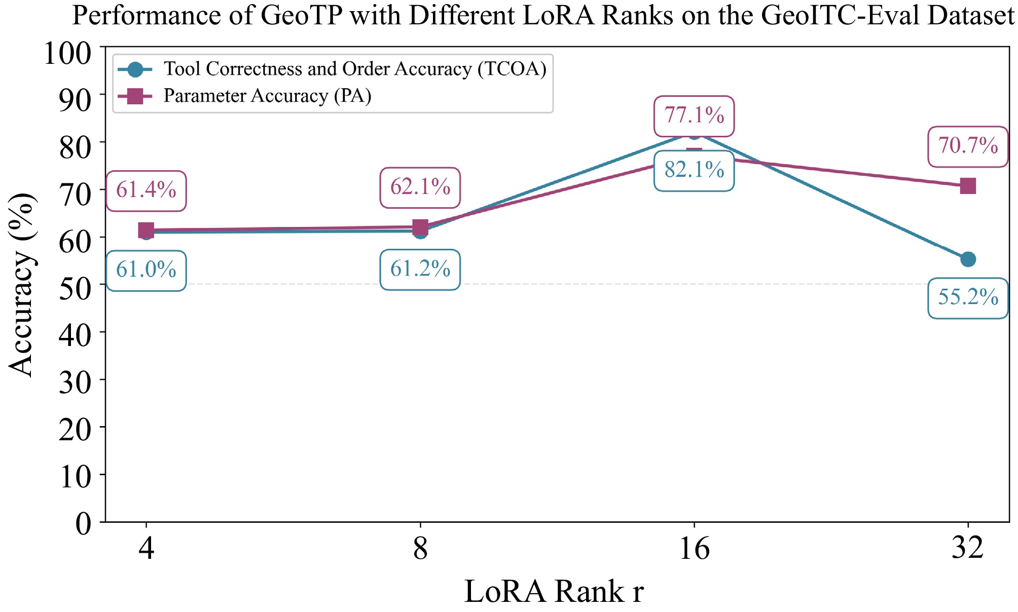
Figure 11.
Performance of GeoTP with different LoRA ranks on GeoITC-Eval.
-
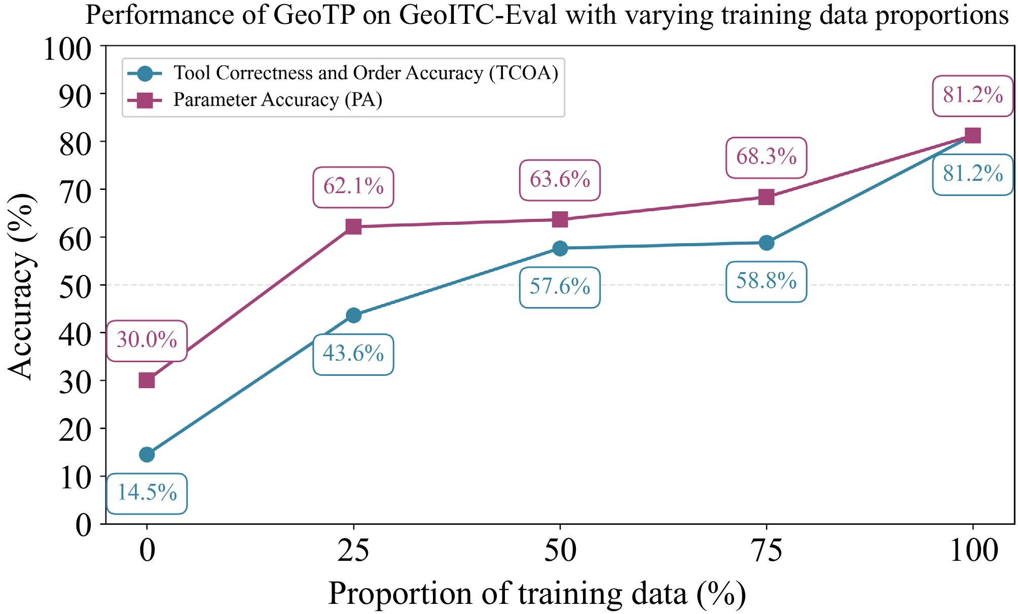
Figure 12.
Performance of GeoTP with different proportions of training data on GeoITC-Eval.
-
No. Tool name Function description Parameter name 1 OSM Downloader This tool allows users to download OpenStreetMap (OSM) data by selecting an area using a rectangle. Download Area, Output Format 2 OpenTopography DEM Downloader This tool downloads Digital Elevation Models (DEMs) for the extent defined by the user from OpenTopography. DEM Type, Download Extent, Output Raster 3 Points Along Geometry This algorithm creates a point layer with points distributed along the lines of an input vector layer. Input Layer, Distance, Start Offset, End Offset, Output Layer Table 1.
Specification of sample geospatial tools in GeoITC.
-
Number of tools 1 2 3 Total Number of instructions 630 2,740 2,088 5,458 Table 2.
Statistics of the instruction tuning data in GeoITC.
-
Number of tools 1 2 3 4 5 Total GeoITC-Eval 270 90 60 0 0 420 GeoITC-EvalProlong 0 0 0 30 20 50 GeoITC-EvalExtend 15 15 15 0 0 45 Table 3.
Statistics of the GeoITC-Eval,GeoITC-EvalProlong and GeoITC-EvalExtend.
-
No. Tool name Function description Parameter name 1 Clip This algorithm clips a vector layer using the features of an additional polygon layer. Input Layer, Overlay Layer, Output Layer 2 Difference This algorithm extracts features from the Input layer that fall completely outside or only partially overlap the features from any of the Overlay layer(s). Input Layer, Overlay Layer, Output Layer 3 Aspect This algorithm calculates the aspect of the Digital Terrain Model in input. Input Layer, Z Factor, Output Layer Table 4.
The information of three external geospatial tools.
-
Number of tools 1 2 3 Number of instructions 270 90 60 LLaMA-8B CTOA 7.8%(21) 26.7%(24) 26.7%(16) PA 21.5%(58) 42.4%(38) 50.0%(30) DeepSeek-v3.1 CTOA 62.6%(169) 63.3%(57) 50.0%(30) PA 53.0%(143) 43.3%(39) 65.0%(39) Qwen3-max CTOA 54.1%(146) 54.4%(49) 28.3%(17) PA 50.4%(136) 43.3%(39) 51.7%(31) GeoTP CTOA 91.5%(247) 65.6%(59) 58.3%(35) PA 90.0%(243) 48.9%(44) 61.7%(37) Best results are in bold. Table 5.
The results obtained by baselines and GeoTP on the evaluation dataset GeoITC-Eval.
-
Number of tools 4 5 Number of instructions 30 20 LLaMA-8B CTOA 10.0%(3) 35.0%(7) PA 6.7%(2) 25.0%(5) DeepSeek-v3.1 CTOA 20.0%(6) 40.0%(8) PA 40.0%(12) 35.0%(7) Qwen3-max CTOA 16.7%(5) 45.0%(9) PA 36.7%(11) 20.0%(4) GeoTP CTOA 66.7%(20) 50.0%(10) PA 76.7%(23) 50.0%(10) Best results are in bold. Table 6.
The experiment results of baselines and GeoTP on the evaluation dataset GeoITC-EvalProlong.
-
Number of tools 1 2 3 Number of instructions 270 90 60 LLaMA-8B CTOA 0.0%(0) 0.0%(0) 0.0%(0) PA 0.0%(0) 33.3%(5) 6.7%(1) DeepSeek-v3.1 CTOA 20.0%(3) 13.3%(2) 6.7%(1) PA 46.7%(7) 13.3%(2) 6.7%(1) Qwen3-max CTOA 60.0%(9) 40.0%(6) 40.0%(6) PA 33.3%(5) 33.3%(5) 6.7%(1) GeoTP CTOA 60.0%(9) 53.3%(8) 53.3%(8) PA 60.0%(9) 46.7%(7) 40.0%(6) Best results are in bold. Table 7.
The experiment results obtained by baselines and GeoTP on the evaluation dataset GeoITC-EvalExtend.
-
Number of tools 1 2 3 DeepSeek-v3.1 5.818 7.926 11.672 GeoTP 8.511 12.358 17.378 Table 8.
Average time (seconds) for GeoTP and DeepSeek-V3.1 to process geospatial tasks in GTChain-Eval.
Figures
(12)
Tables
(8)